Watch this space for updates on new iOS mobile applications currently under development.
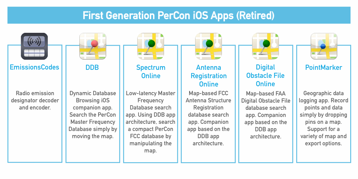
Our first generation of iOS apps are now officially retired.